One Roof Peterborough Announces Extended Hours During Heat Warning

One Roof Community Centre will be open for extended hours until 9:30 p.m. on Tuesday and from 8:30 a.m. to 9:30 p.m. on Wednesday and Thursday due to a heat warning issued by Environment and Climate Change Canada.
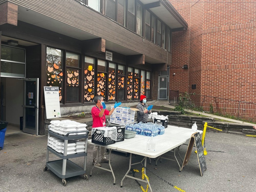
file photo.

Environment and Climate Change Canada that is forecasting temperatures up to 33 degrees for the Peterborough area.

One Roof Community Centre, which provides services on behalf of the City and County of Peterborough, is located at 99 Brock Street. Lunch will be served between 1 p.m. to 2 p.m.

For full description of meals and other services that One Roof provides, visit the website. For information about how to protect yourself from extreme heat, visit the Government of Canada website. 

Water Filling Stations

Outdoor water bottle filling stations are available at City facilities in the following locations:

  • Quaker Foods City Square, 215 Charlotte St.

  • Eastgate Park, 2150 Ashburnham Dr.

  • Peterborough Marina, 92 George St. N.

Members of the public are also able to refill a water bottle inside the following City facilities during hours of operation:

  • Peterborough Public Library, 345 Aylmer St.

  • Peterborough Sport and Wellness Centre, 775 Brealey Dr.

  • Healthy Planet Arena, 911 Monaghan Rd.

  • Kinsmen Civic Centre, 1 Kinsmen Way.

Homelessness Services

Emergency shelters are open and available to people experiencing homelessness who require emergency overnight shelter:

  1. YES Shelter for Youth (705-748-3851), 196 Brock St.

  2. Brock Mission Men’s Shelter (705-748-4766), 217 Murray St.

  3. Cameron House Women’s Shelter (705-748-4766), 738 Chemong Rd.

  4. Overflow Shelter at 210 Wolfe St. (705-748-4766 – ask for Overflow Shelter)

Emergency After Hours Services related to emergency shelter are available through the Social Services by calling 705-926-0096. The Peterborough Social Services website has full details on the website.

Engage with us on social media on Twitter, Instagram, Facebook and Tiktok. Write to us at tips@ptbocanada.com. Sign up for PTBOBuzz newsletter here.

Flood Watch Update Issued For Trent-Severn Waterway Tuesday

A Flood Watch Update was issued for Municipalities of Selwyn, Douro-Dummer, Asphodel-Norwood, Otonabee-South Monaghan, Cavan Monaghan, City of Kawartha Lakes, Peterborough and Trent Hills, and Otonabee Conservation’s other partners in flood emergency management on Tuesday April 11– notifying them that flooding is possible.

file photo.

The waterways within Otonabee Conservation’s jurisdiction and the headwaters of the Trent-Severn Waterway (Reservoir Lakes/Haliburton Lakes region) will experience above normal air temperatures through Sunday April 16.  The next rainfall event is forecasted for the 16th is through Tuesday April 18 with potential rainfall amounts in the range of 15 to 30 millimetres. 

Parks Canada is currently managing water through the entire Trent-Severn Waterway.  With the increased flows entering the Kawartha Lakes, water levels will continue to increase and result in breakup of ice cover and potential ice jams. Flooding of low-lying areas along the Kawartha Lakes and Rice Lake shoreline is expected.  

Water levels and flows on the Otonabee River have levelled off and will remain steady.  Potential increases to water levels and flows may result from further water management due to additional runoff from the forecasted rainfall event. Flooding of low-lying areas along the Otonabee River is expected. 

Otonabee Conservation advises area municipalities to prepare for swelling of rivers, streams, creeks and wetlands with possibility of waters inundating adjacent properties and roads. Shoreline residents and businesses are strongly encouraged to take action to limit or prevent damages due to potential flooding. Residents and visitors are advised not to drive, cycle, or walk through flooded areas and to obey all road/traffic closures. Adults, parents and caregivers are advised to keep themselves, children and pets away from all waterways and conveyance structures (i.e., dams, culverts and bridges). 

Water levels can be monitored on-line at: 

  1. Trent-Severn Waterway’s Water Management InfoNet

  2. Water Survey of Canada Real-Time Hydrometric Data   

  3. Otonabee Region Conservation Authority website  

This Flood Watch Update message will expire Tuesday, April 18 unless updated earlier.                                                               

Engage with us on social media on Twitter, Instagram, Facebook and Tiktok. Write to us at tips@ptbocanada.com. Sign up for PTBOBuzz newsletter here.

The City of Peterborough Lifts Significant Weather Event Declaration From Saturday's Snowstorm

The City of Peterborough lifted its Significant Weather Event declaration as of 5 p.m. Tuesday that was issued on Saturday due to a major snowstorm.

Photo by Aaron Elliott.

Environment Canada recorded that Peterborough received about 25 cm of snow from Friday to Saturday.

City of Peterborough Public Works employees were deployed throughout the storm and subsequent days to address conditions on roads, sidewalks and trails.

Declaring a Significant Weather Event is a way to advise residents, pedestrians, cyclists and motorists conditions on roads, sidewalks and bike lanes can be expected to be delayed compared to typical levels of service, due to the severity of a storm according to the City.

Engage with us on social media on Twitter, Instagram, Facebook and Tiktok. Write to us at tips@ptbocanada.com. Sign up for PTBOBuzz newsletter here.

One Roof Community Centre Extends Service Hours Feb. 23 to 25 Due to Weather Forecast

One Roof Community Centre is extending its hours of service to 8:30 a.m. to 9:30 p.m. beginning Thursday until Saturday, Feb. 25 due to cold temperatures and a winter storm in the forecast for the area.

file photo.

One Roof Community Centre, which provides warming room services on behalf of the City and County of Peterborough, is located at 99 Brock St. A meal is provided between 1 p.m. and 2 p.m. A full description of meals and other services that One Roof provides is online.

Information about how to protect yourself from extreme cold is available on the Peterborough Public Health website.

Emergency shelters are open and available to people experiencing homelessness who require emergency overnight shelter. If shelter capacity is full, temporary alternative accommodations for overnight stays may be made available. Please contact the shelters first for space:

Emergency After Hours Services related to emergency shelter are available through the Social Services by calling 705-926-0096. The Peterborough Social Services website has full details.

Engage with us on social media on Twitter, Instagram, Facebook and Tiktok. Write to us at tips@ptbocanada.com. Sign up for PTBOBuzz newsletter here.

Winter Storm Watch Calling For Heavy Precipitation Issued For Peterborough

A Winter storm watch has been issued for Peterborough on Tuesday; in effect for late Wednesday and into Thursday as a winter storm is expected.

file photo.

The Weather Network says precipitation may fall heavily at times leading to hazardous winter travel conditions, and may also mix with freezing rain in some areas.

There remains some uncertainty for the exact location, timing and accumulations of snow and ice pellets. Warnings may be issued as the event draws nearer.

Rapidly accumulating snow could make travel difficult over some locations. Travel is expected to be hazardous due to reduced visibility in some locations. Surfaces such as highways, roads, walkways and parking lots may become icy and slippery. There may be a significant impact on rush hour traffic in urban areas.

To keep up with weather updates visit the website.

Engage with us on social media on Twitter, Instagram, Facebook and Tiktok. Write to us at tips@ptbocanada.com. Sign up for PTBOBuzz newsletter here.

Otonabee Conservation Issues Flood Watch Amid Snowfalls Forecast for Peterborough and Surrounding Areas

A flood watch update was issued by Otonabee Conservation for the Trent-Severn Waterway (Kawartha Lakes, Otonabee River, Rice Lake, Trent River to Hastings) and local watercourses on Tuesday, warning communities that signifiant precipitation could lead to flooding.

File Photo.

The Flood watch, issued to Municipalities of Selwyn, Douro-Dummer, Asphodel-Norwood, Otonabee-South Monaghan, Cavan Monaghan, City of Kawartha Lakes, City of Peterborough and Trent Hills and ORCA’s other partners in flood emergency management, states that precipitation accumulation could lead to flooding.

Falling snow and wind chill are ingredients that contribute to cooling of river/stream/creek water, promoting and accelerating the generation of frazil ice. Multiple days of frazil ice generation increases the possibility of frazil ice accumulation causing channel constriction and the back-up of water behind the accumulation/constriction, leading to flooding of adjacent low-lying areas.

Starting Tuesday night and continuing for the next 7 to 10 days, the forecast is for wind chills that will drop overnight lows well into the double-digits.

Beginning Wednesday afternoon and continuing through Thursday morning, Otonabee Conservation says a strong low-pressure system will bring high winds, cold air temperatures and significant snowfall. They are alerting municipalities, residents and businesses that floods are possible with those snowfalls expected in the next couple days, and advising those in low-lying, flood-prone areas to keep an eye out for frazil ice generation, accumulation and rising water levels and to prepare for potential flooding.

Wednesday and Thursday’s total snow accumulations are expected to be around 20 centimeters across the watershed. This winter storm is expected to be followed by a series of minor weather disturbances bringing more snow, albeit low accumulations and continued cold air temperatures into the early days of February.

Thursday and Friday’s temperature low is expected to be - 19 degrees while feeling closer to - 22 degrees.

Water levels can be monitored online at:

  1. Trent-Severn Waterway’s Water Management InfoNet

  2. Water Survey of Canada Real-Time Hydrometric Data 

  3. Otonabee Region Conservation Authority website

This flood watch message will expire Feb. 2 unless updated earlier.

Engage with us on social media on Twitter, Instagram, Facebook and Tiktok. Write to us at tips@ptbocanada.com. Sign up for PTBOBuzz newsletter here.

Share

Special Weather Statement in Effect for Peterborough and Kawartha Lakes; Significant Snowfall Expected

A special weather statement has been issued for Peterborough and Kawartha Lakes areas as Environment Canada calls for 10 to 15 centimetres of snow on Wednesday.

File photo.

The special weather statement released Jan. 23 at 12:17 a.m. is in effect for Apsley, Woodview, Lindsay, Peterborough City and Lakefield, calling for significant snowfall late Wednesday and into Thursday.

Environment Canada warns that rapid snow accumulation could lead to reduced visibility, making driving more difficult. Snow accumulation certain municipalities may reach up to 20 centimetres.

To keep up with monitors and alerts through Environment Canada, visit the website.

Engage with us on social media on Twitter, Instagram, Facebook and Tiktok. Write to us at tips@ptbocanada.com. Sign up for PTBOBuzz newsletter here.

Share

Otonabee Conservation Issues Flood Watch to Peterborough and Surrounding Area

A flood watch update has been issued by Otonabee Conservation for the Trent-Severn Waterway and local watercourses on Thursday, urging residents to keep close watch for frazil ice.

file photo.

At 12:30 p.m. Thursday, Otonabee Conservation issued a flood watch for the Trent-Severn Waterway (Kawartha Lakes, Otonabee River, Rice Lake and Trent River to Hastings) and other local watercourses, alerting municipalities, residents and businesses that flooding is possible.

As a result of rainfall and snowmelt across the Trent-Severn, Parks Canada is managing high water levels and flows through the entire system. These high flows are expected to continue along the Otonabee River for the next seven to ten days, according to Otonabee Conservation.

The winter storm forecast is expected to generate frazil ice which may lead to flooding. Frazil ice (a kind of slush ice) can form when cold air temperatures and wind chill combine to cause surface water temperature to be super-cooled, but is unable to form a solid cover of ice because of fast moving water.

As frazil ice flows downstream, Otonabee Conservation says it will eventually come to rest against obstructions such as islands, bridge piers and abutments, in low velocity areas (bends, slope reductions) or in areas of channel constrictions, where it will accumulate. Where frazil ice accumulates, it is likely to cause a restriction of water flow downstream, resulting in a rise of water and possible flooding behind the frazil ice build-up.

Residents and businesses along the shores of the Otonabee River and Kawartha Lakes are strongly encouraged by Otonobee Conservation to keep a close watch for frazil ice generation, accumulation and jamming, and to take action to limit or prevent damages due to potential flooding.

This flood watch will expire Jan. 19 unless updated earlier.

Water levels can be monitored online at:

Engage with us on social media on Twitter, Instagram, Facebook and Tiktok. Write to us at tips@ptbocanada.com. Sign up for PTBOBuzz newsletter here.

Fog Advisory Issued for Peterborough and Surrounding Areas

Environment Canada has issued a fog advisory for Peterborough and surrounding areas 11 a.m. Thursday.

stock photo.

Environment Canada is calling for rain showers into the afternoon Thursday, with a few flurries beginning around noon. Areas of dense fog are expected to continue into the afternoon, bringing near-zero visibility in some areas. Environment Canada warns those travelling to be prepared while driving, and to slow down, watch for tail lights ahead and be prepared to stop abruptly.

2 to 4 centimetres of snowfall are expected later in the afternoon Thursday, with a wind chill of minus 8 are into the evening and overnight.

On Friday, another 2 to 4 centimetres of snow is expected, with temperatures staying steady at - 3. A low of - 10 is expected in the evening on Friday with a 40 per cent chance of flurries.

Engage with us on social media on Twitter, Instagram, Facebook and Tiktok. Write to us at tips@ptbocanada.com. Sign up for PTBOBuzz newsletter here.

Share

Otonabee Conservation Issues Flood Watch to Peterborough and Surrounding Area Due to Warm Weather and Rainfall

Otonabee Conservation has issued a flood watch to Peterborough and the surrounding area due to the warm temperatures, rainfall and melting snow throughout the holidays announced on Thursday.

The watch is for the municipalities of Selwyn, Douro-Dummer, Asphodel-Norwood, Otonabee-South Monaghan, Cavan Monaghan, City of Kawartha Lakes, City of Peterborough and Trent Hills and ORCA’s other partners in flood emergency management according to Otonobee Conservation.

The flood watch is issued to alert municipalities, residents and businesses that floods are possible.

Parks Canada reports that they are managing water throughout the entire system.  Increased flows are entering the Kawartha Lakes that increase water levels and could result in the potential breakup of ice cover and ice jams. Starting Thursday, the flows on the Otonabee River will be increased to convey the excess water within the system.

Otonabee Conservation expects a return of cold air temperatures over the next week, in combination with a lack of ice cover and turbulent flows on the Otonabee River may result in the generation of frazil ice (a kind of slush ice formed by cold air temperatures and wind chill combine to cause the surface water temperature to be super-cooled) which can lead to flooding.

Residents and businesses along the shores of the Otonabee River and Kawartha Lakes — especially those located in low-lying areas — are strongly encouraged by Otonobee Conservation to keep a close watch for frazil ice generation, accumulation, and jamming and to take action to limit or prevent damages due to potential flooding.

Water levels can be monitored online at:

The flood watch is expected to expire next Thursday unless stated otherwise.

Engage with us on social media on Twitter, Instagram, Facebook and Tiktok. Write to us at tips@ptbocanada.com. Sign up for PTBOBuzz newsletter here.