
Road Closures In Effect For Sunday's 25th St. Patrick's Day Parade
/Road closures, parking restrictions and Peterborough Transit detours will be in place during the St. Patrick’s Day parade starting at 2 p.m. on Sunday.
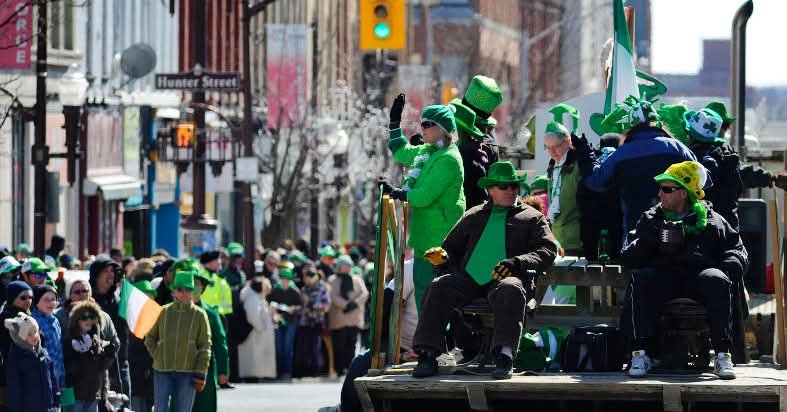
Photo courtesy of the Peterborough St. Patrick's Day Parade.
To allow for staging and procession of the parade, the following road closures will be in place starting at 12:30 p.m. until 4 p.m.:
Dublin Street between Aylmer Street and Water Street
London Street between Aylmer Street and Water Street
McDonnel Street between Aylmer Street and Water Street
Murray Street between Aylmer Street and Water Street
George Street from Parkhill Road West (south side of intersection) to Brock Street
The parade will travel south on George Street beginning at McDonnel Street. During the parade, a rolling road closure will be in place along George Street from Brock Street to McGill Street. All road closures are expected to be over by 4 p.m.
‘No Parking’ signs will be posted in advance of the road closures.
Residents and visitors are encouraged to park in the following downtown locations:
King Street Parkade at 202 King St.
Simcoe Street parking garage at 190 Simcoe St.
Chambers Lot at 184 Hunter St.
Reid Lot at 350 Reid St.
Del Crary Lot at 100 George St. N.
Downie Lot at 336 Downie St.
Parking in municipal lots and parking garages is free on weekends.
Parking enforcement will start on Sunday morning once signage is in place. Parking contrary to posted signage during a road closure event may result in a $35 penalty notice and towing. Any vehicles not moved from the street in the parade staging area and route may be towed to the Eastgate Memorial Park parking lot, 2150 Ashburnham Dr., to make space for the float assembly and procession.
The following transit routes will have detours during the closure period: Route 2 Chemong, Route 4 Weller, Route 6 Sherbrooke, Route 7 Lansdowne, Route 9 Parkhill, Community Bus 22 (Blue) and Community Bus 23 (Red).
Route 2 Chemong
During the rolling road closure at 2 p.m.:
Southbound from Terminal: route follows Simcoe Street to Aylmer Street to Romaine Street to Park Street to Braidwood Avenue to Lock Street.
Northbound from Lansdowne Street at Borden Avenue follows the regular route to Lock Street to Braidwood Avenue to Park Street to Romaine Street to Aylmer Street to Simcoe Street.
Route 4 Weller
During the rolling road closure, westbound will follow a regular route to the terminal only. Eastbound will travel to the bus stop at Simcoe at Water Streets. Customers will walk east to catch the bus at the Simcoe and Water streets stop. An extra driver will cover the east side of the route for the 2:23 p.m. trip
Route 6 Sherbrooke
Southbound from Trent from 12:30 p.m. to about 3:30 p.m. follows the regular route on George Street to Parkhill Road, west on Parkhill to Reid Street and follows Route 2 to the terminal.
Northbound from Terminal during the rolling road closure at 2 p.m. follows Route 2 to Reid Street at Parkhill Road, travelling east on Parkhill to Water Street where it resumes its regular route
Route 7 Lansdowne
During the rolling road closure at 2 p.m.:
Westbound follows its regular route to Lock Street, left on Lock Street and taking Braidwood to Park Street to Lansdowne Street, where it returns to the regular route
Eastbound follows the regular route to Park Street, right on Park Street and taking Braidwood to Lock Street to Lansdowne Street, where it returns to the regular route
Route 9 Parkhill
From 12:30 p.m. to about 3:30 p.m.
Westbound from Trent: Regular route to George Street at Parkhill Road, continuing along Parkhill Road to the regular route
Eastbound from Fleming: Regular route to Parkhill at Reid, continuing along Parkhill Road to the regular route


