City of Peterborough Declares Significant Weather Event Ahead of Weekend Ice Storm

The City of Peterborough has declared a significant weather event, effective immediately, in advance of the ice storm expected this weekend.

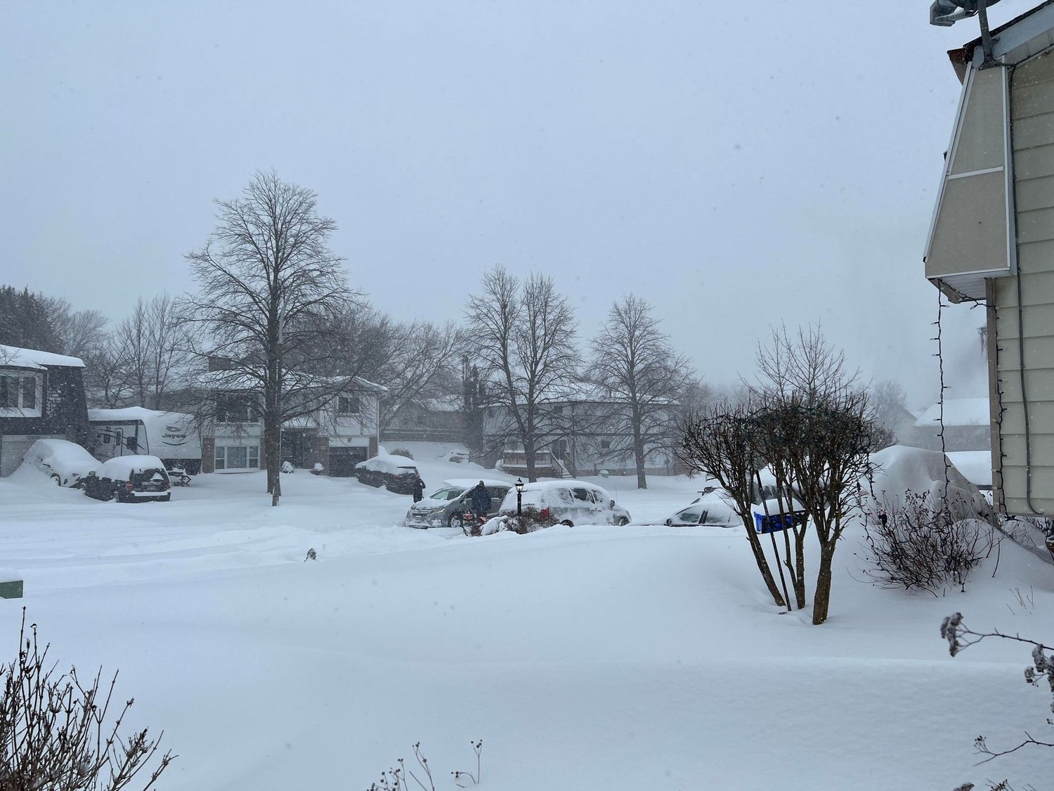
Photo courtesy of the City of Peterborough.

The City is actively monitoring weather forecasts and conditions. Winter abrasives and de-icers are ready to go, and Public Works crews are ready to deploy the City’s 18 plow trucks, 11 sidewalk plows, two graders, seven loaders and backhoes to help keep roads, sidewalks and trails clear.

Crews will work throughout the weekend to keep roads clear; however, depending on the storm's severity, ice accumulation may still occur on roads, sidewalks, and parking lots.

Environment Canada has issued a special weather statement for the region, forecasting a potent spring storm that will begin late Friday and last until Monday.

Significant ice accumulation can result from freezing rain, with general amounts of five to 15 mm and amounts in excess of 20 mm possible. Environment Canada warns that utility outages, slippery surfaces, and broken tree branches from ice build-up are a possibility.

City forestry crews are standing by, ready to clear fallen branches and trees that may become an issue.

To report a downed branch or tree on City property please call Public Works at 705-745-1386. This line is answered 24 hours a day, seven days a week

Due to ice accumulation, there is potential for power outages. Residents should be prepared if an extreme weather event results in a power outage.

Having an Emergency Preparedness kit on hand is essential for staying safe.

Emergency Preparedness Kits should include:

  • Battery-powered or windup flashlight

  • Battery-powered or windup radio

  • First Aid Kit

  • Portable external battery charger for cellphones, laptops, etc.

  • Water (Two litres per person per day)

  • Canned or dried food that won’t spoil

  • Manual can opener

  • Extra batteries for your flashlight or radio

  • Cash- if there is an extended power outage, many stores may only be able to accept cash as a form of payment

  • Blankets

  • Candles and matches

  • A list of emergency numbers and important contacts

Residents are encouraged to charge devices in advance of a weather event.

Motorists should also ensure enough fuel in their vehicles before the storm, as local gas stations may also lose power.

Residents should ensure that downspouts are directing rain away from the foundations of buildings. 

Residents can help by clearing debris away from the storm sewer drains near their property if possible.

Due to the volume of water moving through local waterways, residents are reminded to stay a safe distance from the water’s edge as banks can be slippery and unstable.

Otonabee Conservation has issued a Flood Warning for all watercourses in our region. Residents are advised to monitor conditions and take appropriate action to protect themselves and their property from flooding.

Engage with us on social media on Twitter, Instagram, Facebook, Tiktok, Youtube and LinkedIn. Write to us at tips@ptbocanada.com. Sign up for our newsletter here.

Peterborough and Parts of the County Could Face Potent Spring Ice Storm From Friday to Monday

Environment Canada has issued a special weather statement for a likely potent spring ice storm that will hit Peterborough, Lakefield and parts of southern Peterborough County from late Friday until Monday.

File Photo.

Significant ice accumulation can result from freezing rain, with general amounts of five to 15 mm and amounts in excess of 20 mm possible. Environment Canada warns that utility outages, slippery surfaces, and broken tree branches from ice build-up are a possibility.

A break in the freezing rain is expected for most areas late in the day on Saturday into Saturday night before a second round of freezing rain begins.

Environment Canada believes the likelihood of an increase in a widespread, prolonged freezing rain event is occurring over portions of southern Ontario. The swath of maximum ice accretion is still uncertain but confidence is highest for central and eastern Ontario areas between Parry Sound and Kingston. Environment Canada will issue warnings as the event draws nearer.

Engage with us on social media on Twitter, Instagram, Facebook, Tiktok, Youtube and LinkedIn. Write to us at tips@ptbocanada.com. Sign up for our newsletter here.

Share

Otonabee Conservation Issues Watershed Conditions Statement

Watershed Conditions Statement - Water Safety has been issued for all watercourses within the jurisdiction of Otonabee Conservation, with the exception of the Trent-Severn Waterway.

otonabee conservation logo

With widespread rainfall over the next few days, Otonabee Conservation says high-than-normal water flows and levels that could be dangerous are expected, although flooding is not a concern.

Total local rainfall amounts of 30 to 45 mm are predicted over the next 24 hours with showers becoming heavier at times with the risk of thunderstorms this evening and overnight and into the day on Wednesday.

While flooding is not expected, Otonabee Conservation says the forecasted rainfall will create ponding in low lying areas, roadways and higher-than-normal water levels and flows on all local watercourses.

The alert is in-effect until Thursday afternoon at 3 p.m., unless updated earlier.

Engage with us on social media on Twitter, Instagram, Facebook, Tiktok, Youtube and LinkedIn. Write to us at tips@ptbocanada.com. Sign up for our newsletter here.

Peterborough Expected to Get Heavy Rain and Thunderstorms In Special Weather Statement

Peterborough, Lakefield and Southern Peterborough County are expected to get heavy rain in slow-moving thunderstorms on Friday according to Environment Canada.

Photo by Keegan Beekers.

Torrential downpours are expected with rainfall amounts of 30 to 60 mm but could even be higher. The rainfall is expected to continue into this evening.

Heavy downpours can cause flash floods and water pooling on roads according to Environment Canada. Localized flooding in low-lying areas is possible.

Engage with us on social media on Twitter, Instagram, Facebook, Tiktok, Youtube and LinkedIn. Write to us at tips@ptbocanada.com. Sign up for our newsletter here.

Share

Peterborough and the Kawarthas Under Severe Thunderstorm Watch For July 24

Peterborough, Lakefield and southern Peterborough County are under a severe thunderstorm watch that began Wednesday morning through until the evening.

Photo courtesy of Jay Callaghan.

Environment Canada says conditions are favourable for developing severe thunderstorms. These may produce strong wind gusts up to 90 km/h, torrential downpours with 50 mm falling within an hour, nickel- to Toonie-sized hail, and heavy rain.

These conditions can cause significant damage. Large hail can damage property and cause injury. Strong wind gusts can toss loose objects, damage weak buildings, break branches off trees and overturn large vehicles. Heavy downpours can cause flash floods and water pooling on roads. Water-related activities may be unsafe due to violent and sudden gusts of wind over bodies of water.

Emergency Management Ontario recommends taking cover immediately if threatening weather approaches. Go indoors if you hear thunder roar.

Engage with us on social media on Twitter, Instagram, Facebook, Tiktok, Youtube and LinkedIn. Write to us at tips@ptbocanada.com. Sign up for our newsletter here.

Share

Peterborough Could See Heavy Rainfall Wednesday and Thursday From Hurricane Beryl Remnants

Peterborough and parts of the County could receive heavy rainfall due to the remnants of Hurricane Beryl on Wednesday and Thursday according to Environment Canada.

Photo courtesy of Dave Ellis.

Peterborough, Lakefield and southern parts of the County are the potential affected areas.

Rainfall is expected to begin either late Tuesday night or Wednesday and continue into Thursday.

Torrential downpours are estimated to bring 20 to 40 mm per hour at times while localized rainfall totals possibly well over 50 mm.

Although confidence in the weather system's exact track is low, these systems have produced very high rainfall rates in torrential downpours in the past says Environment Canada.

Engage with us on social media on Twitter, Instagram, Facebook, Tiktok, Youtube and LinkedIn. Write to us at tips@ptbocanada.com. Sign up for our newsletter here.

Share

Peterborough and Kawartha Lakes Under Tornado Watch

Peterborough and the Kawarthas are under a tornado watch according to Environment Canada to develop this afternoon and continue into the evening.

Photo courtesy of Tyler George.

Weather conditions are favourable for the development of severe thunderstorms which may produce tornadoes. Strong winds, large hail and heavy rain are also possible.

The risk of tornadoes can see strong winds gusting to 110 km/h with nickel-to-toonie-sized hail.

In case of severe weather, take cover immediately if threatening weather approaches.

Photo courtesy of Instant Weather.

In the event of a tornado or if a tornado warning is issued for your area, Environment Canada recommends the following actions:

  • Go indoors to a room on the lowest floor, away from outside walls and windows, such as a basement, bathroom, stairwell or interior closet.

  • Leave mobile homes, vehicles, tents, trailers and other temporary or free-standing shelters and move to a strong building if possible.

  • As a last resort, lie in a low spot and protect your head from flying debris.

Engage with us on social media on Twitter, Instagram, Facebook, Tiktok, Youtube and LinkedIn. Write to us at tips@ptbocanada.com. Sign up for our newsletter here.

Share

Peterborough and the Kawarthas Under Severe Thunderstorm Watch

Peterborough and the Kawarthas are under a severe thunderstorm watch that can take effect on Wednesday.

Photo courtesy of Jay Callaghan.

Conditions favour developing severe thunderstorms that may produce strong wind gusts, large hail and heavy rain according to Environment Canada.

Wind gusts of around 100 km/h could accompany toonie-sized hail. The risk of a tornado is highest this afternoon and evening.

Thunderstorms will develop along a cold front moving through the province this afternoon and evening. The main threats will be strong winds and hail but tornados are also possible.

Large hail can damage property and cause injury. Strong wind gusts can toss loose objects, damage weak buildings, break branches off trees and overturn large vehicles. Heavy downpours can cause flash floods and water pooling on roads. Environment Canada advises that water-related activities may be unsafe due to violent and sudden gusts of wind over bodies of water.

Residents are urged to go indoors then thunder roars for risk of lightning.

Engage with us on social media on Twitter, Instagram, Facebook, Tiktok, Youtube and LinkedIn. Write to us at tips@ptbocanada.com. Sign up for our newsletter here.

Share

Selwyn Lifts Significant Weather Event From Friday

After reviewing Environment Canada weather reports and current conditions, the Township of Selwyn’s Significant Weather Event has been lifted, announced on Monday morning.

Photo by David Tuan Bui.

The Significant Weather Event was declared on Friday due to the impending winter storm.

The Township says that the weather has subsided enough that it can meet their required maintenance objective timelines.

Drivers and pedestrians are reminded to use caution while navigating in winter weather conditions. Selwyn assures that their Public Works crew are continuing with regular winter maintenance activities.

Engage with us on social media on Twitter, Instagram, Facebook, Tiktok, Youtube and LinkedIn. Write to us at tips@ptbocanada.com. Sign up for our newsletter here.

Selwyn Declares Significant Weather Event With Impending Winter Storm

Environment Canada has issued a winter storm warning for Friday as conditions continue, announced by the Township of Selwyn.

Photo by David Tuan Bui.

The township urges those to consider postponing nonessential travel until conditions improve. Poor weather conditions may contribute to transportation delays.

The Township of Selwyn is declaring a significant weather event, as per Ontario Regulation (O. Reg.) 366/18 section 16.9; which amended O. Reg. 239/02.

As per Regulation 366/18, an Ontario Municipality may declare a significant weather event when a weather hazard is approaching or occurring and can potentially pose a significant danger to users of the roadways over which they have authority.

This declaration suspends the standard timelines required for municipalities to meet their winter maintenance objectives until the municipality declares that the significant weather event has ended. In each case, during a declared significant weather event, the standard for addressing winter maintenance is to monitor the weather and deploy resources to address the issue starting from when the municipality deems it appropriate. When the municipality has declared the event has ended, the standard timelines for winter maintenance activities will begin.

The Township of Selwyn wishes to note that the declaration of a significant weather event is not a notice of a reduced level of service. The declaration is to notify the residents of the Township that due to the current forecasted conditions, caution is to be exercised when travelling on Township maintained roads, and it may take longer than usual to bring the conditions of the roads back to a state of repair.

Engage with us on social media on Twitter, Instagram, Facebook, Tiktok, Youtube and LinkedIn. Write to us at tips@ptbocanada.com. Sign up for our newsletter here.